DFS lets drones fly safely 

Road traffic is guided by signs, traffic lights and traffic rules. In manned aviation, airspaces, flight routes and, above all, air traffic control ensure the orderly flow of traffic. Unmanned aviation also needs a traffic system. We have developed such a UAS traffic management system, or UTM for short, jointly with Deutsche Telekom.  

Traffic management for drones

The position of the drone is displayed, together with the air traffic in the immediate vicinity, in a digital air situation display. The UTM thus creates an essential basis for being able to use drones in an economically sensible way by enabling flights beyond the visual line of sight of the drone pilot. 

An LTE modem, the so-called hook-on device (HOD), is used to locate the drone. It transmits position, camera and sensor data using mobile telephony. In the same way, it receives control and mission data and forwards them to the flight system. In addition, the HOD receives transponder signals via ADS-B (Automatic Dependent Surveillance - Broadcast) and the traffic information and collision avoidance system FLARM. For this development, the project partners (DFS and Deutsche Telekom) were awarded the German Mobility Prize in 2018. 

In order to market this hitherto unique tracking technology and to bundle all other services related to the use of drones, DFS and Deutsche Telekom have founded the joint venture Droniq GmbH, which is based in Frankfurt am Main, Germany. It offers services for almost all phases of flight in commercial and private drone operations based on technologies developed by DFS. In addition to the UTM system, Droniq also provides consulting and safety assessments for flights and approval procedures.

www.droniq.de
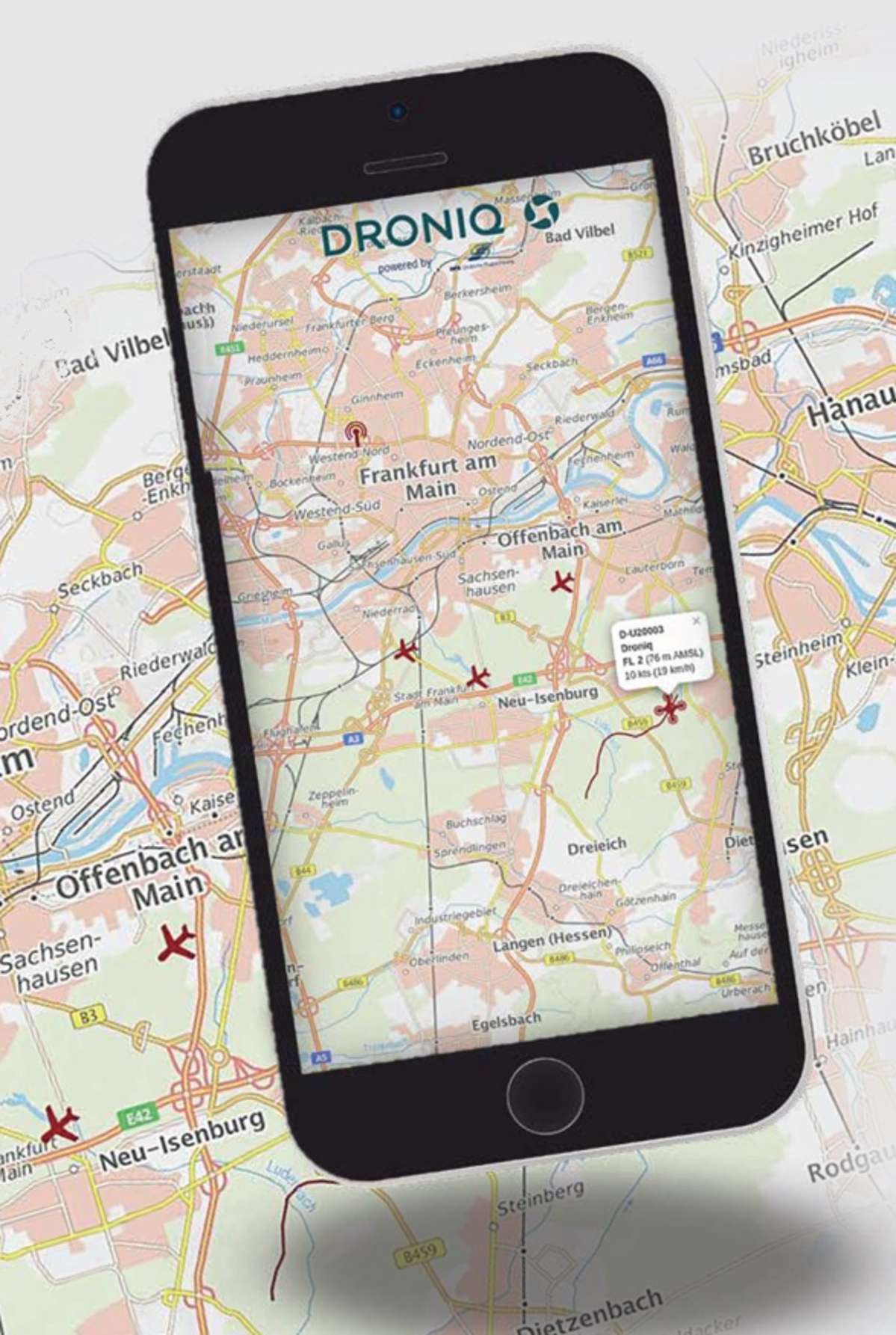

screenshot of drone detection system


Structure of the UTM system 

The DFS UTM system can be viewed as a pyramid in which the individual UTM functions are built on each other.


  • Central database 

    A database with all registered UAS, drone operators (companies or individuals), flight plans and geographical information. 

  • Charts/cartography 

    Up-to-date airspace display with topography, satellite images or city and street maps. In addition, no-fly zones, other airspaces and further relevant information can be displayed. 

  • Positioning and flight path tracking  

    Precise positioning, for example by mobile telephony or transponder, as well as detection, continuous flight path tracking and fusion with, among other things, altitude, speed and direction information of all aircraft (manned and unmanned).

  • Mission data processing  

    Digital processing of flight plans and flight mission data, including take-off site, take-off time, flight route and the planned landing site. The UTM system uses these data to check whether the flight plan complies with all rules and the airspace structure. If necessary, the flight planning will be adjusted.

  • Environmental data 

    Display of weather conditions, such as ground wind and precipitation as well as the Kp index. The Kp index measures the magnetic effect of solar radiation, which in turn can affect the GPS connection.

  • Safety functions 

    Based on the collected data from the previous functions, the UTM system can detect and display conflicts at an early stage.

  • Mission planning

    Based on the mission data, such as flight planning and the identified conflicts, the UTM system determines which flight path changes can resolve a conflict. 

  • Conflict detection and avoidance 

    In a future development, the UTM system could transmit the control commands to the drone in question in a fully automated way to avoid conflicts.

  • Air traffic flow management 

    In the future, traffic flow prediction and control will be the pinnacle of all UTM functions. It is conceivable that potential conflicts and their appropriate resolution are managed at such an early stage that the smooth flow of UAS traffic is ensured at all times.

  • User interface (HMI) 

    Ultimately, each UTM system user receives an individual user interface. The HMI (human-machine interface) provides an air situation in which, among other things, manned and unmanned air traffic are shown on one display. It is used by air traffic control for airspace coordination, by authorities for approval procedures and by safety authorities and organisations to monitor UAS traffic. The UAS pilot receives, for example on a smartphone or tablet, an air situation display showing the air traffic in the immediate vicinity as well as all relevant flight and airspace information.


U-Space


flying drones


U-Space sandbox in the Port of Hamburg 

In a test project, DFS and its subsidiary Droniq established Germany's first U-Space real laboratory, or sandbox, in the Port of Hamburg. The sandbox has shown that U-Space, as envisaged in the EU Regulation, works. The concrete results were summarised in a final report and made available to the German Federal Ministry of Transport. The project was initiated by the Ministry with funding of one million euro. 

U-Space Real Laboratory Hamburg


LUV: The optimal U-Space 

DFS and its subsidiary Droniq worked together in a project consortium to optimise the implementation of the EU U-Space Regulation. U-Space, a geographically defined area with special traffic rules for drones, is a concept of the European Union Aviation Safety Agency (EASA) and can be implemented by EU Member States since the beginning of 2023. The projects aim was to develope solutions and recommendations for the implementation of the U-Space Regulation throughout Germany.  

www.luv-projekt.de (German only)  


flying drones