Air traffic control and wind energy

The radar and navigation facilities of DFS are vital for air safety and their operation needs to be protected from outside interference. Wind turbines can interfere with these facilities, which is why conflicts can arise as new wind energy projects are being planned. Nevertheless, even in the protection zones around these facilities the number of wind turbines is increasing. Our new calculation method to measure any potential interference is paying dividends. Even more will be possible in the future.

To ensure safe air traffic, DFS operates numerous technical air navigation service facilities for communication, navigation and surveillance. Exposed locations, such as hilltops or mounds as well as open spaces, offer ideal conditions for these facilities. This is because interference-free transmission is essential to ensure that our air traffic controllers have access to reliable radar information and that pilots can adhere to the specified flight path when navigating.
However, the expansion of wind energy in Germany means that DFS facilities are increasingly facing competition. This is because wind turbines benefit from the same geographic conditions that are optimal for air navigation facilities. The problem with this is that wind turbines can interfere with these facilities. This applies in particular to radar facilities and ground-based navigation facilities, so-called omnidirectional radio beacons.
Transmitting and receiving stations for the radiocommunication service ensure communication between pilots and air traffic controllers.
Radar facilities ensure that air traffic controllers always know the exact position of aircraft.
Navigation facilities help pilots determine their position.

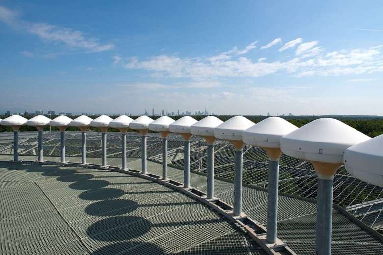
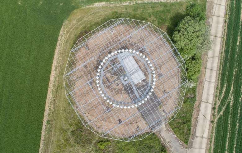
VORs (very high frequency omnidirectional radio range) and DVORs (Doppler very high frequency omnidirectional radio range) are the lighthouses of the skies. These facilities continuously broadcast a rotating radio signal – hence the term omnidirectional – as well as a reference signal for the magnetic north pole. These signals are received and processed by aircraft and are used by pilots as an orientation aid.
If wind turbines or other structures stand too close to such beacons, they can interfere with the signal of the navigation facility by reflecting it. This reflection reaches the receiver on the aircraft in addition to the original signal and leads to bearing errors, i.e. distorted directional information.
To avoid such interference, the International Civil Aviation Organisation (ICAO) provides for the establishment of protected areas around these facilities. There is no blanket ban on building in such areas. However, these areas are relevant in any process for issuing building permits. In these areas, each construction project must be assessed separately to determine whether the construction could interfere with air navigation facilities.
With regard to the size of these protected areas, DFS is guided by new scientific findings that we developed together with the National Metrology Institute of Germany (PTB) as part of a research project funded by the German Federal Ministry for Economic Affairs and Climate Protection (BMWK). On the basis of the reassessment, DFS reviewed the protected areas around a total of 40 ground-based navigation facilities (DVOR). With only one exception, the radius has been reduced from 15 kilometres to 7 kilometres, less than a quarter of the original size. This has freed up an area of more than 21,000 square kilometres for the expansion of wind power.
Interactive map of the protected areas (German only)
Tabular overview (German only)

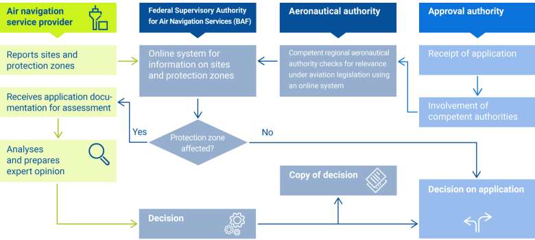
DFS, as the operator of the air navigation facilities, plays an important role in the approval of construction projects within protected areas. On behalf of the German Federal Supervisory Authority for Air Navigation Services (BAF), DFS examines whether the planned structure may interfere with the signals of air navigation facilities. This process is stipulated in the German Aviation Act (LuftVG).
If the structure in question is a wind turbine, DFS has been using an assessment method modified according to the latest scientific findings of the National Metrology Institute of Germany (PTB) since mid-2020. With its help, we can estimate the specific interference caused by wind turbines better than before.
We use ICAO standards and recommended practices when assessing these results. Subsequently, DFS draws up an expert opinion. On this basis, the BAF decides whether the construction project applied for could interfere with air navigation facilities and notifies the approval authority responsible for the planned construction project of the decision.
www.baf.bund.de (German only)
Note: This assessment process does not include the additional scenario-based preliminary assessment of wind priority areas offered by DFS. This preliminary assessment for wind energy sites must be requested separately from DFS and is intended exclusively to support planning authorities in the determination of areas for wind energy (Section 3 of the German Act on the Need for Wind Energy Sites, WindBG). However, this preliminary assessment can currently only be carried out for wind turbines that are planned further than three kilometres away from a (D)VOR.

By 2030, we will have converted the approach and departure procedures at all designated international airports in Germany to predominately satellite-based navigation procedures as part of a European programme. This creates space for the decommissioning of omnidirectional radio beacons, and thus for new wind turbines.
However, we cannot completely do without ground-based navigation facilities. In Germany, there is currently no obligation to use satellite navigation and equip aircraft with satellite receivers. In addition, the ground-based facilities serve as a backup in case the satellite signals should ever be unavailable or disrupted.
Therefore, we must continue to maintain our ground-based navigation facilities but on a much smaller scale. Our existing facilities are continuously being renewed in the process. We are replacing conventional omnidirectional radio beacons with the more technically sophisticated Doppler VHF omnidirectional radio range (DVOR), which are less susceptible to interference.

DFS also checks whether a planned structure may pose an obstacle to the aircraft themselves in addition to the requirements for the protection of facilities. This assessment is carried out on behalf of the aeronautical authorities of the federal states (Landesluftfahrtbehörde), without the involvement of the German Federal Supervisory Authority for Air Navigation Services (BAF). Here, DFS may recommend certain constraints, such as height restrictions, day and night markings for better visibility or publication, for example in the Aeronautical Information Publication (AIP). However, if this is not sufficient, DFS can also reject the construction project.
In Germany, all construction projects above a certain height and in the vicinity of airports (in the protected areas) are monitored throughout the country. The basis for this is the German Aviation Act (LuftVG). The act obliges the projects to be submitted to the competent aeronautical authority. Due to their height and scale, wind turbines are also subject to this obligation.
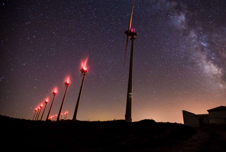
Obstacle protection also applies to cross-country flights because pilots need to know where tall obstacles are to be expected on the flight path. For low-flying aircraft, such as rescue helicopters, all structures above a height of 100 metres above ground are therefore published on aeronautical charts. At night, obstacles must have sufficient lighting to be visible to pilots.
DFS is continuously modernising its navigation infrastructure. VHF omnidirectional radio beacons (VOR) make up one part of this infrastructure. Since 2002, we have decommissioned 17 VORs, and another 20 or so will follow by 2032, as part of the switch to satellite navigation. In addition, conventional VORs (CVOR), which are more susceptible to interference, are being replaced with more robust Doppler VORs (DVOR). This creates even more space for wind turbines and thus supports the energy transition Germany is striving for.

The following facilities are planned to be decommissioned in the next few years:
CVOR:
DVOR:
The following facilities are planned to be converted from CVOR to DVOR in the next few years:
Please note: